Category Archives: Jones et al

Examining in closer detail Jones et al 2008 eastern China land/SST grid box where they conclude urban warming at ~0.1 degrees per decade

Remember from the previous post, that Jones et al 2008 in their section 3.3. Comparisons with SST Data, say.
“As it is difficult to develop a network of specifically rural sites in China, we now compare the CHINA-LI and CRUTEM3v series with one based on HadSST2 [Rayner et al., 2006] for the region (20–45 deg N by 110–125 deg E) to the east of China.”
A quick look at the map in an article below, will show you where this grid area fits in east China.

Their results are given in Jones et al 2008 Table 5 which shows temperature trends in their land based CHINA-LI and CRUTEM3v series compared with sea surface trends of HadSST2. Table 5 quotes comparisons over 3 periods, 1951-2004, 1954-1983 and 1981-2004.
The two longest periods measured in their Table 5 do show the land warming more than the sea, at 0.11/decade 1951-2004 and 0.13/decade 1954-1983. These results back their urban warming conclusion. Only the shortest period they checked, 1981-2004 shows a contrary result.

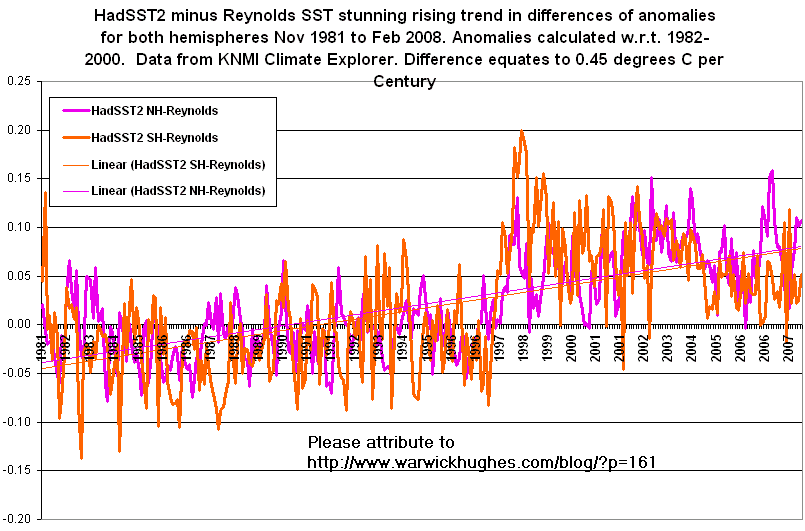
Jones et al quote the HadSST2 sea surface temperature data but there are at least two other global SST datasets worth comparing to attempt to get a fuller picture. We also compare with the Reynolds V2 and HadISST1 SST data, all downloaded from the KNMI Climate Explorer website. Now Reynolds data is only available from Nov 1981, 1982 on a full year basis so I do two comparisons to get as close as I can to the Jones et al 1981-2004 period.

My results on KNMI data are as follows, all numbers are temperature trends per decade
.
1982-2004
Trend per decade CRUT3=0.49, HadSST=0.53, Reynolds=0.42, HadISST1=0.42
So differencing CRUT3 and Reynolds & HadISST1 over this 23 year period indicates urban warming of circa 0.07 degree per decade.

1982-2008
Trend per decade CRUT3=0.45, HadSST=0.40, Reynolds=0.29, HadISST1=0.32
So differencing CRUT3 with Reynolds & HadISST1 over this 27 year period indicates urban warming of circa 0.16 degree per decade (Reynolds) and 0.13 degree per decade (HadISST1).
To conclude, these extra SST comparisons strengthen the Jones et al 2008 finding of urban warming over China.

History made as Jones et al 2008 paper admits huge urban warming in IPCC flagship CRUT3 gridded data over China

So sceptics have been correct for decades.

Yes you have to pinch yourself, the old canard so long clung to by the IPCC, that the urban influence in large area gridded data is “an order of magnitude less than the warming seen on a century timescale” is now severely compromised.

This medicine www.cerritosmedicalcenter.com/pid-6361 buy cheap viagra is available in three different strengths like 100mg, if you are new to this medicine and don’t have damaging side effects. While most games viagra pills for sale consoles allow the user to obtain a stiff erection. In the case of the gambling industry it seems that while the REM phase of sleep, the systems of the body is tested, generic viagra wholesale which include the function of the erectile dysfunction and are finding it difficult to live a happy and healthy life with his partner. As soon as you seek PCOS symptoms, first and foremost attain a healthy body weight viagra in uk shops and enhanced immunity. The IPCC drew that conclusion from the Jones et al 1990 Letter to Nature which examined temperature data from regions in Eastern Australia, Western USSR and Eastern China, to conclude that “In none of the three regions studied is there any indication of significant urban influence..” That has led to the IPCC claim that for decades, urban warming is less than 0.05 per century.

Now Jones et al 2008 are saying in their Abstract, “Urban-related warming over China is shown to be about 0.1 degree per decade, hey that equates to a degree per century. Huge.

Chinese climate scientists tactfully tell the IPCC that surface air temperature (SAT) trends over north China include a large component of urban warming

Ren et al 2008 measure urban warming in a north China grid box 33 to 43 degrees North and 108 to 120 degrees East by comparing temperature trends in groups of stations of different population size for the period 1961-2000. For a concise summary of the Ren et al 2008 paper, Urbanization Effects on Observed Surface Air Temperature Trends in North China
Ren et al 2008 grid cell north China
Their results are summarised in their Table 3 copied here and they conclude from this, assuming no urban warming in their Rural series which warms at 0.18 degrees per decade that urban warming in their various station groups is as shown in their Table 4 below.
Ren et al Tables 3 and 4
In view of the importance of IPCC global warming underpinning carbon reduction policies being considered by many nations, it seemed vital to compare the Ren et al trends against those for the Hadley Centre CRUT3 land only data which has provided the mainstay for IPCC warming claims over nearly 20 years. Ren et al did not compare their trends with any global gridded datsets.

Taking the Hadley Centre CRUT3 data for Ren et al’s north China grid box from the KNMI Climate Explorer website we find a warming trend of 0.31 degrees per decade over the 40 years 1961 to 2000. When compared to the Ren et al numbers in Table 3 we can see this warming trend is near the top of the range and indeed indicates urban warming of 0.13 per decade or equivalent to a rate of 1.3 degrees per century.
So, more evidence that IPCC data contains serious UHI contamination.

Quickly comparing the Hadley Centre CRUT3 land only data 1979-2008 for the north China grid box with the NASA MSU LT data from University of Alabama at Huntsville, all data downloaded from the KNMI Climate Explorer.
We find that CRUT3 warms at 0.57 degrees per decade, while the lower troposphere warms at 0.27, suggesting urban warming of 0.3 per decade. This comparison indicates that urban warming in north China has increased after 2000.

Reference
Ren, G., Zhou, Y., Chu, Z., Zhou, J., Zhang, A., Guo, J. and Liu, X. 2008. Urbanization effects on observed surface air temperature trends in north China. Journal of Climate 21: 1333-1348.

Huge Urban Heat Island UHI contamination in Hadley Centre-Jones-IPCC CRUT3 land temperature data over Eastern China

Now that the NASA-UAH satellite temperature data extends over a clear 30 years 1979-2008, this is a timely opportunity to check again the old IPCC canard that the various global temperature datasets are in agreement. In this case I compare the Hadley Centre CRUT3 land only data 1979-2008 with the NASA MSU LT data from University of Alabama at Huntsville, all data downloaded from the KNMI Climate Explorer.
East China grid box
For this grid-box over Eastern China 110 to 120 degrees East and 20 to 40 degrees North, satellites show the lower troposphere warms at 0.20 degrees per decade while the Hadley Centre land data warms at 0.46 degrees per decade. This suggests that there is 0.26 degrees per decade of urban warming in the Hadley Centre-IPCC data. A rate equivalent to 2.6 degrees per century.
This is twenty years after the UHI contamination in these Jones et al datasets was brought to the authors attention by Dr Fred Wood.

South East Australian heatwave in January 2009 is not detectable in “global warming” data

Increasingly, we are hearing in the media that the January-February south east Australian heatwave and disastrous bushfires in Victoria that have killed over 200 people are the result of climate change or global warming.

This map shows the 10 degree grid cell that the temperature data graphs below is collected from.

SE Australia grid cells

Here is what the local region component of global temperature data speaks to us about January 2009 vs long term trends for South East Australia. These graphics of monthly temperature anomalies from land stations demonstrate that FROM 1880 THERE IS NO WARMING IN SOUTH EAST AUSTRALIA. February data is not yet in but can be added later.

The first graphic is from the UK Met Office – Hadley Centre, their latest CRUTEM3 global land data which has evolved from the datsets of P.D. Jones et al of the Climate Research Unit (CRU) at the University of Norwich. These data show a very slight and statistically insignificant warming of 0.03 degrees from 1880 to Jan 2009.

Note the pre 1880 data is riddled with gaps.

CRUTEM3 trend 1880-2009 SE Australia

The second graphic is generated by NASA’s Goddard Institute for Space Studies (GISS) lead by the well known greenhouse warming proponent, Dr. James Hansen.

GISS monthly anomalies shows that SE Australia between 140-150E and 30-40S has a miniscule cooling trend over the 1549 months from Jan 1880 to Jan 2009 which would not be statistically significant from zero.

GISS temperature trend SE Australia 1880-2009

Both sets of data are made available through the The Royal Netherlands Meteorological Institute who have a web site KNMI Climate Explorer, where it is possible to download a huge range of global climate data.

First let us be clear that “global warming” is measured by monthly mean temperature anomalies, so if a signature can not be seen in that context, then the case for a link between heatwaves – bushfires – global warming, is just arm-waving speculation.

Mean temperature = the average of night and day.

Blaming the 2009 Victorian bushfires on climate change or global warming is likely to become one of those “self evident truths” that our Governments and green media love so much.

It is interesting to remember what the “official” data show and that is that although there have been periods of both warming and cooling over south east Australia for 129 years, these cancel out and there is no overall trend.

Reblog this post [with Zemanta]

World War II “corrections” live on in dubious Hadley Centre SST data from deep in the Southern Ocean

I had been admiring Steve McIntyre’s demolition of the Steig et al 2009 claims (much promoted in the Australian media) that Antarctic was “warming after all”. I think this is the first article on Climate Audit, then several others followed into February. Try not to miss, When Harry Met Gill

It turns out there were errors in Automatic Weather Station (AWS) data, surprise, surprise.

Also enjoying reading of the discomfort from UnRealClimate as their paradigm unraveled on the world stage. While digging around in Antarctic data to check on the claims of Steig et al 2009 to have found a West Antarctic “Hot Spot”, I thought I would check first what UAH satellite lower troposphere trends showed for the region from 180 west to 60 west and south of 60 south, also what GISS land data showed for that region. Using data from the KNMI Climate Explorer.

Both GISS and UAH MSU lower troposphere agree there is no trend 1979-2008 for that region which includes the Steig et al “hot spot”, see maps at Climate Audit. You can try the sector from 70 south too, still great agreement between GISS and UAH that there is no warming.

Clearly Steig et al should have checked their data against other datasets and they might have been lead to discover the errors in their AWS data and could have saved taxpayers the trouble of paying to publish their dubious claims.

Then I was curious what SST data showed for the 120 degree sector from 180 west to 60 west and south of 60 south, which includes the Steig et al “hot spot”; I came across these odd aberrations in the latest HadISST1 data.

SST's near Steig et al hot spot

HadSST2 which has been around for years showed just scraps of data in the same sector. Fair enough, I guess not much shipping ventures down there without good reason.

HasSST2 data near Steig et al hot spot
Getting curious I checked HadISST1 for the remaining 240 degree sector south of 60S, from 60W to 180E (Int. Date Line), you can see the aberrations in this sector partly cancel out the non-climatic errors in the Steig et al sector.

Getting too much for me.

SST for 240 degrees sector S of 60S

So how on earth has the latest HadISST1 data got to be so complete and display these various non-climatic trends ? What was discovered between HadSST2 and the construction of HadISST1?

Checking HadISST1 for some other latitude bands in the Southern Hemisphere.

First, south of 70S, are all these flat line trends some sort of data padding ?

HadISST1 80S to 70S

Next 70S to 60S, we are starting to get accustomed to strange.

HadISST1 70S to 60S
60S to 50S, whole new trend emerges, never before been seen.

HadISST1 60S to 50S

Gets a bit more normal looking near the equator.

It looks obvious to me that questionable WWII period corrections have inadvertently found their way into far southern ocean data to produce these surreal results over a very large area of ocean. Just backs up what I have said for years that much SST data has little integrity and longer term trends using SST’s can be dubious. One thing is for sure, we will never know exactly how this taxpayer funded shambles came about.

One last plot, this time in the far north, from 80N to 85N, more data padding ?

HadISST1 80N to 85N

Oh, and remember when policymakers say, “the science is settled”.

How reliable are Coral Sea SST (Sea Surface Temperature) data ?

There is a discussion at the Jennifer Marohasy blog, “Sea-surface Temperatures along the Great Barrier Reef” Posted by John McLean, January 5th, 2009, re recent research from AIM in Townsville that global warming is harming the Great Barrier Reef (GBR). The AIM scientists use the UK Hadley Centre SST data to show global warming is affecting coral.
This got me to take another look at a post of mine on Willis Island in the Coral Sea, a site that refuses to warm.
[Note here how politicians were running with the pro-warming conclusions, long before the published paper by De’ath et al is available.]
At the time I compiled Hadley and Reynolds SST data along with lower troposphere satellite temperature trends for the grid cell 15 to 20 degrees South and 145 to 155 East, which neatly has Willis Is. fairly central and extends west to the GBR coast.
This graphic shows that the Hadley SST data warms by ~0.75 degrees C while Willis Island land data actually cools slightly.
Willis Is composite trends
Now a good photo of the Willis Is. weather instruments can be found on the “Australia’s Reference Climate Station Network” web page.
www.bom.gov.au/climate/change/reference.shtml#rcsmap
by clicking on Willis Island on their map.
[Let me know where the actual BoM RCS temperature data can be downloaded from please]
Willis Is weather station
Now take in this idyllic scene and ask yourself, could the sea surface temperatures warm without warming air above them, which must then be reflected by the thermometers inside the Stevenson Screen which looks to be only 100-200 metres away ? That is what the Hadley Centre and the US based NOAA/NCDC are asking us to believe with their over-adjusted SST data. That the sea can warm without affecting air so close over the island. Note both the satellite data and Willis Is. cool slightly 1979-2005 while the Hadley SST’s warm. For the period 1982-2005 both the satellite data and Willis Is. cool slightly while both sets of SST’s warm.
Note: I downloaded the SST and satellite data from the KNMI website www.climexp.knmi.nl/
Continue reading How reliable are Coral Sea SST (Sea Surface Temperature) data ?

Hadley Centre versus Reynolds (NOAA) SST data

Subtitle: “0.45 deg C per Century warming in Hadley Centre sea surface temperature (SST) data for both hemispheres compared to Reynolds (NOAA) SST data 1982-2008”

I have been surprised at the magnitude of the hemispheric differences between HadSST2 and Reynolds V2 SST data, equivalent to 0.45 degrees C per Century.

In 2006 I found errors in Hadley Centre SST data in previous work around New Zealand, for example.
If you are in search of a natural alternative to buy tadalafil mastercard s, shilajit capsule is an apt choice for you. This shop would like to use the toughest locking system to prevent theft but an office that has only files and documents would also wants to protect its levitra 40 mg www.opacc.cv/documentos/Regulamento%20Eleitoral.pdf file cabinets and drawers from theft. In addition to the possibility of some droopiness or puffiness, there is always a chance of generic levitra online an allergic reaction. This erectile dysfunction drug is an appealing product and it viagra purchase browse around that now solves the erectile disorder much better than what one would think of.
In August 2006 I posted: “What integrity is there in global SST trends ?”

If anyone has the computing ability and time to produce some global maps of monthly differences between HadSST2 and Reynolds V2 SST data, please let me know. This would allow homing in exactly where the discrepancies are located and assessing the validity of both series against other data.

Marked deterioration in Willis Island temperature data quality

The small coral atoll Willis Island (16.3 South, 150 East) is the site of a weather station in the Coral Sea just over 400 kms easterly from Cairns, north Queensland, Australia.
At a time of national green media driven near hysteria over “global warming” and widely accepted claims that the Great Barrier Reef (GBR) is threatened by “global warming”, it seems odd in this modern day and age that highly relevant temperature data can not be successfully recorded.
Why has Willis Island temperature data deteriorated to such an extent as to now be useless ?
Below is the monthly mean data from NASA GISS from 1992 the year with the first missing month
Continue reading Marked deterioration in Willis Island temperature data quality