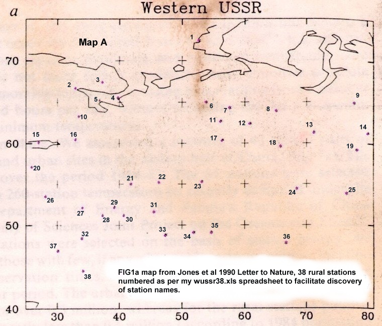
| I have numbered the rural
stations 1 to 38 and they are so listed on my wussr38.xls
worksheet where I am recording progress towards
identifying all of the 38 stations. It is interesting that five of the 38 stations are outside the area of gridded data. Eg. 9, 14, 19, 25, on the east side and 38 in the SW. |
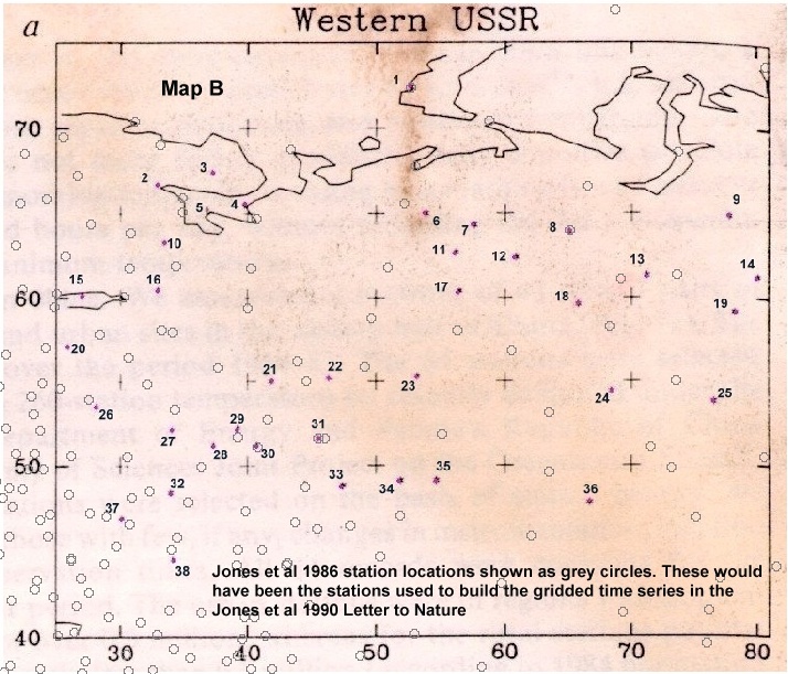
| Map B shows the locations of station used to generate the Jones et al
1986 gridded data in use at
the time their 1990 Letter to Nature was written. We see
that as Jones et al 1990 states, there are only 4 stations shared
by both the rural and gridded Jones et al series, these are, 1, 8, 30
and 31. To make this map, the image of Jones et al 1990 FIG
1a was "registered" in mapping software using the Latitude
& Longitude grid points and then the software allows
superimposition of new layers of data based on excel
spreadsheets. |
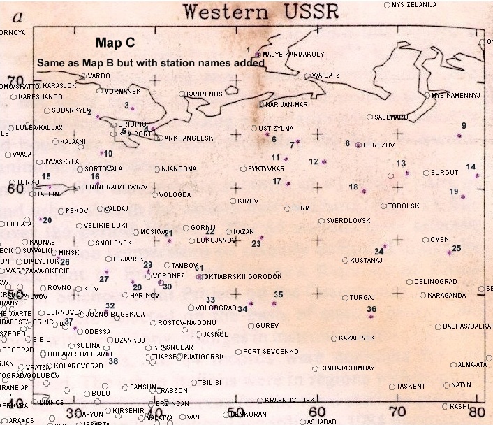
| Map C is simply Map B with
station names added. The spreadsheet indicates
where
station names have been sourced and will be updated as work progresses. |
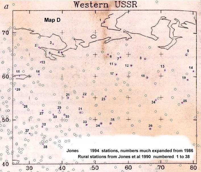
| Map D is of course the same base
map but with station locations of Jones 1994 greatly
expanded series. Now we see 12 stations common to both
the rural
and gridded series, 1, 8, 9, 11, 12, 18, 21, 30, 31, 34, 35 and
36. This means that in the few years between the two papers, 26
of the 38 rural stations (68%) were deemed unfit to include in the 1994
station list. |
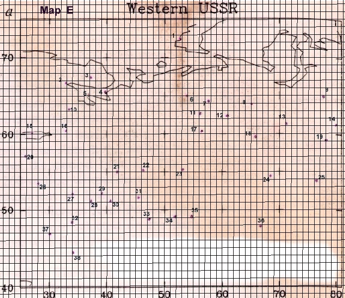
| Map E is the Map A base
map but with a 1 degree latitude and longitude grid
superimposed by software. This will lead to the most
accurate estimate of lat & long possible given the errors
inherent in my original photocopy, scanning, etc. These estimated lat
& long numbers will be added to my spreadsheet downloadable
above. I am hoping that the 24 Feb 2007 post on my
Blog, "Does anybody have a very detailed list of
Russian met station locations ?" will lead me to the
inventory file of Russian met stations that I am looking for. |
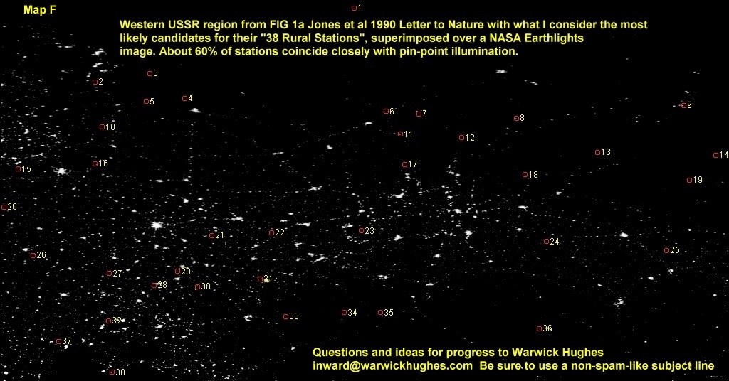
| Map F is a crop from the
HiRes
NASA Earthlights image, and has the 38 rural stations
superimposed by mapping software, the stations being indentified from
the WMO ? inventory file on the NOAA
website, details sent to me
by Steve McIntyre. We see that 60% of Jones et al 38 stations
correspond with pinpoint
illumination. |
| We now need the station data.
Does anyone have ideas how to get these lower ranking Russian station
data ? By that I mean data not available in GHCN, GISS or the Jones
1994 station data. |