| The Jones et al 1990 approach in
Eastern China is very different when compared to their Western
USSR section, where they compiled a 38 station rural series to measure
against their Jones et al 1986 gridded data. In Eastern China
they set up 42 urban / rural station pairs with data only for 30
years, and then compare these trends to their gridded data
and to one another. 30 years is a short enough period that data
inhomogeneities can play a large part in affecting trend comparisons. |
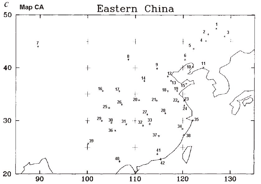
| Starting with the FIG 1c map labelled
MAP CA, I have numbered the urban / rural
station pairs 1 to 42 in black and they are so listed on my echina42.xls
worksheet where I am recording progress towards
identifying all of the 84 stations. Two datasets of Chinese met
records were produced in the 1980's and later updated, these are
available online at CDIAC as a 65 station set and a
205 station set, termed NDP039. These 270 China stations were available at the time Jones et al 1990 was written so seem a logical place to begin identifying the 84 stations in the 42 urban / rural pairs. |
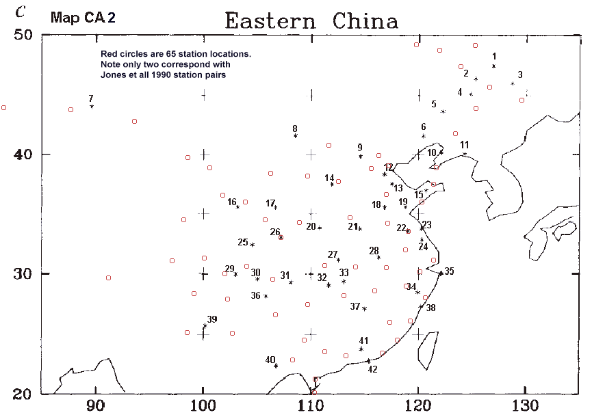
| Map
CA2 has been registered for latitude and longitude and has
the 65
station locations added as red circles plotted by
mapping software. It is crystal clear that only two sites
correspond with stations in the 65 station datset, these are 22 and 26
of my numbers. As per the above spreadsheet. |
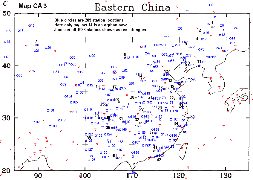
| Map
CA3 is the same base
map but with station locations from the 205 station series.
Now we hit paydirt and see 36 stations with locations that are a
"bullsye" fit over one of the 42 original station points in FIG
1c. Another 3 stations are very close and these are referred to
as
"edge" fits on the spreadsheet. We are left with only 1 station
pair, # 14 with no match in either 65 or 205 station
dataset. For interest this map also has the stations from Jones
et al 1986 global compilation plotted as red triangles. |
| At this point studying Map CA2 and 3 it is obvious that
although we have discovered one matching station for 41 of the Jones et
al 42 points, we have no idea yet of the identities of the
other 42 paired stations. |
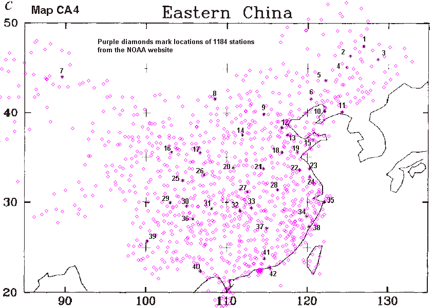
| We have the large global station
list from the NOAA website to check, which
totals ~23,000 sites global and we find 1184 for China.
Superimposing these locations on the lat long registered FIG 1c
map we make Map CA4 and
we see by visual inspection that there may be some candidates for a
nearby "pair" to some of our known 41 stations. It will take a
lot of time consuming analysis and experimentation to make
progress but how much simpler it would be if Jones et al 1990 had
provided a list of station locations when asked. |
| It is worth remembering
here that a comparison of HadCRUT2
vs UAHuntsville lower troposphere satellite temperature trends,
for a block of Eastern China grid cells, 20 to 40 North and 110
to 120 East, shows the surface to be warming at a colossal 0.96 degrees
C
more than the satellites over the 27 years 1979-2005. This
difference equates to about 3.5 degrees per century, yet the IPCC
clings to these gridded data without a blush. |