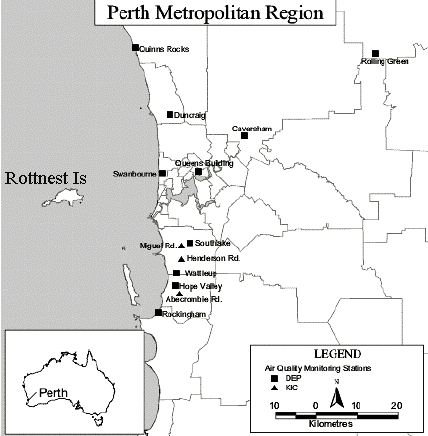
Here we look at air monitoring data that compares ozone (O3) and oxides of nitrogen (NOx) data from Rottnest Island, a rural resort 18 kms off the Perth coast and from Swanbourne, a Perth suburb, for locations see map below from Department of Environment (DoE). The data for Rottnest was only collected for a few years in the 1990's but it provides a valuable comparison to urban areas in the ozone peaks at Rottnest are pretty much equal to peaks in Perth urban areas. The DoE explanation for this is that Perth ozone generated by those harmful car exhaust emissions blows across the 18km to Rottnest. Now Perth is a windy place and in summer there are two main wind systems, easterlies that often blow at night and certainly must take Perth air out to sea and the Fremantle Doctor, a brisk SW sea breeze that gets up in the early afternoon.
What does the air monitoring data show ?
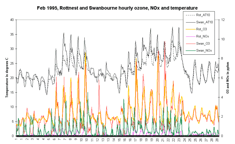
The graph below shows hourly data for February 1995 for ozone, NOx ( I have combined NO and NO2 to keep the graph from being too complex) and temperature for both Rottnest Island and Swanbourne.
Comments on observations;
· ozone peaks are in the early afternoon when solar energy is at a maximum (AT10 is air temperature),
· the few high ozone peaks circa 80 ppb are always on relatively hot days circa + 30 degrees,
· there is more evidence at Rottnest of a late afternoon shoulder from transported ozone (see February graphic),
· Rottnest ozone peaks are often an hour before Swanbourne,
· Swanbourne NOx peaks at night and decays in the early morning,
· on some days there is sign of a small NOx morning traffic peak,
· obviously the NOx hiatus in the middle of the day is a signal of NO2 disassociation contributing to O3 formation,
· however the amount of NOx in the daily cycles indicates that NO2 disassociation might only explain ~25% of O3 formation,
· Rottnest NOx while generally following trends at Swanbourne is markedly lower in amplitude indicating that in the vast majority of cases only significantly diluted Perth air is transported to the island by the easterlies,
· a central observation here is that despite greatly lowered NOx levels on Rottnest compared to Swanbourne - O3 levels at Rottnest are not proportionally lower,
· this backs my central idea that there is a significant natural mechanism contributing to O3 levels in Perth air and one obvious factor that could act as a precurrsor chemical is emissions of Eucalypt leaves from the extensive forests around Perth,
· research in USA indicates that airborne salt could be a significant factor in O3 formation.
On the DoE web site where smog formation is discussed and in their year 2000 annual air monitoring review, Technical Series 111, available on their web site as a pdf file, the DoE gives no attribution to natural ozone sources.
I have data for Caversham (fringe urban) and Rolling Green (rural) which show a similar story to Rottnest / Swanbourne but there is more evidence of late afternoon transported ozone.