I doubt that this dataset was built with surface trends in mind but now we are all aware of the yawning gap in stations from the Sahara / Southern Europe through central Asia to the PRC.
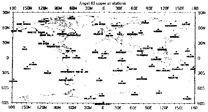
Temperature data and trends from the Jim Angell 63 station upper air dataset (collected at various altitudes from weather balloons) are often quoted in the greenhouse / climate change debate.
Just recently in September 2001 the subject came up again in emails
and out of curiosity I asked the ARL for a station inventory file.
"....a file with 3 fields, station name, latitude, longitude (for sites
where the balloons are launched)".
No station inventory file has come down the line but the map below
was faxed, hence some station names are not immediately apparent.
If anyone has these station names with lats / longs I would appreciate
same.
I doubt that this dataset was built with surface trends in mind but
now we are all aware of the yawning gap in stations from the Sahara / Southern
Europe through central Asia to the PRC.
Posted 4, October, 2001
By Warwick Hughes
www.webace.com.au/~wsh
Back to front page.