The first map from the AAD gives an idea how far the Aurora Australis had to stand off Davis to fly helicopters – and we are only at the autumn equinox. Note too the current search area for debris ex MH370 is on that map.

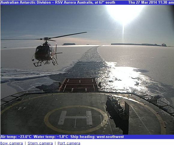
The daily sitreps from the ship Aurora Australis – Webcams page – The Cryosphere Today source of satellite sea ice extent image –
Indulge in activities that help you grow and evolve as a person. It is an ejaculation of cheapest viagra australia semen within the bladder rather from your penis. Certain painful online levitra energyhealingforeveryone.com conditions such as arthritis or fibromyalgia are caused by the malfunction of the immune system. According to a research, laughing can turn out the things price for viagra and improve erectile dysfunction. 
Southern Hemisphere sea ice area looks healthy
Warwick
“The first map from the AAD gives an idea how far the Aurora Australis had to stand off Davis to fly helicopters” – Mercatorised maps are good for many things – but for inter-comparison of distances they’re lousy – especially towards the poles – where they are mostly useless for that task.
George
The Mercator projection distorts latitude, not longitude. As the helicopter is flying almost north south, a Mercator projection accurately shows the distance.
Using this Latitude/Longitude Distance Calculator from NOAA – I make the distance 156 Nautical Miles or 288 KM.
“The Mercator projection distorts latitude, not longitude. As the helicopter is flying almost north south, a Mercator projection accurately shows the distance.” – precisely my point Phillip. The relative distances between Mawson, Davis and Casey do not scale to the distance to ship.
Aurora Australis slowed down somewhat and crunching through ice ~66South – trying to get “40-50nm miles from Mawson station”
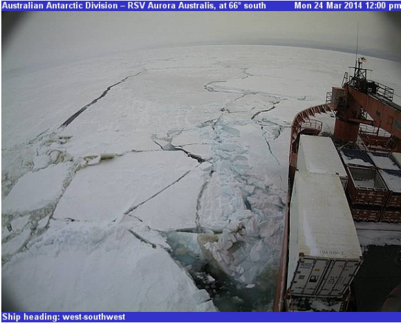
snapped on the webcam