| Starting
out with a BoM map showing main Qld catchments. We will look
through various rain and drought maps and check on the Premier's claim. |  |
| Actual rain totals 1 Jan 19 to 10 Feb 19 showing most rain causing floods was north of the Hughenden - Winton - Mt Isa line | 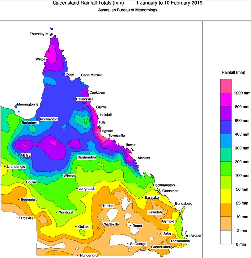 |
| Here is the 2011 drought map and it seems there was no drought in Australia that year - which is year 1 of 8 for the Premier. | 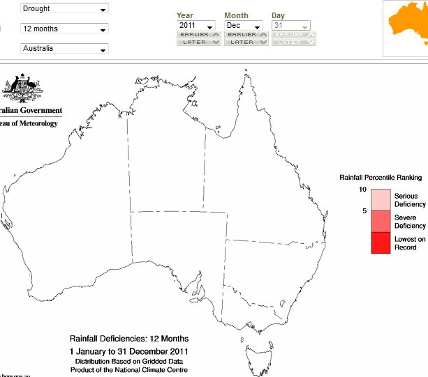 |
| In 2012 there was only a very small area of Qld drought on Cape York | 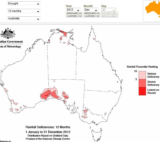 |
| In 2013 sizeable areas of Western Qld were in drought. | 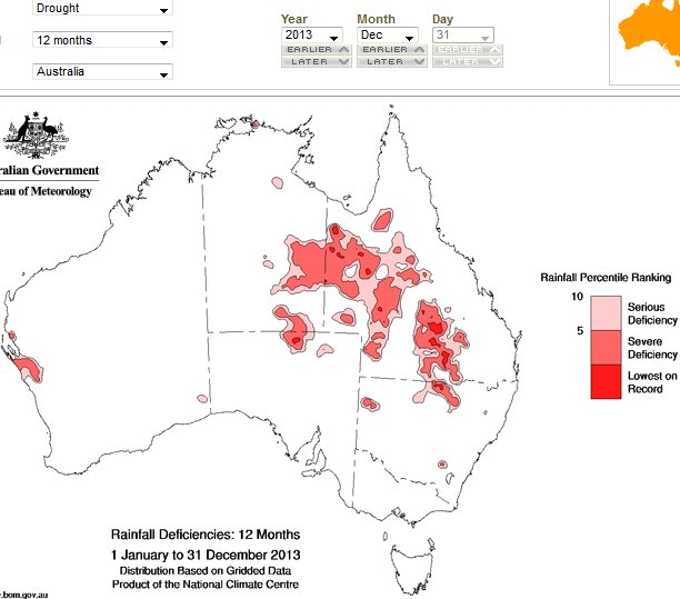 |
| In 2014 only very minor areas west of Townsville were in drought. Plus a few minor areas in SE Qld which is not our subject region. | 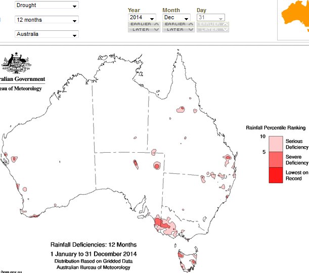 |
| In 2015 Qld had minor areas in drought but not in our subject region. | 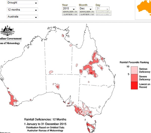 |
| In 2016 there were minor areas of drought in the far north and SE of Qld - but no drought in our subject area. | 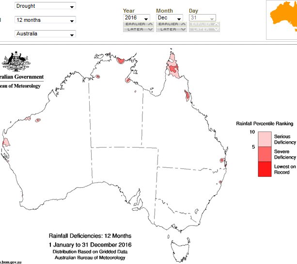 |
| In 2017 there were minor areas of drought is SW Qld but south of our subject area. | 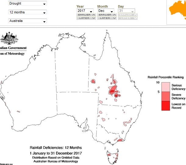 |
| In
2018 the SW Qld drought increased in area joing to NSW and SA areas
- and there was a minute area of drought NW of Mt Isa
in our subject area. | 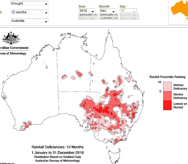 |