More accurate and complete Melbourne Airport 128km BoM weather radar images showing smoke signatures on 7th Februray 2009.
The earlier "black" looking  images from the  National Synoptic radar were from Melbourne and were too incomplete.

11am image no smoke north of Melbourne but showers  west of  Healsville.

Midday.
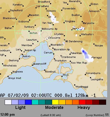
Looking at the 128km Melbourne Airport weather radar for the 7th Feb it indicates a smoke source near Kilmore starting just before 11.40am, notably at exactly the time a smoke plume flares larger between Packenham and Noojee. 

1pm Kilmore plume extends to Mt Dandenong, from prior to Kilmore ignition there have been minor signatures east of Healsville, probably not smoke ?
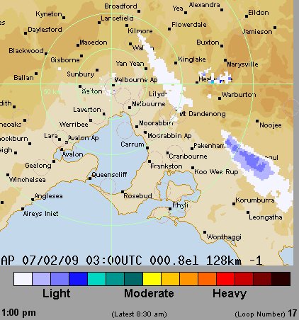
1.10pm Kilmore plume breaks and shows short section at Kilmore then gap to a broader but weaker signature starting midway Kinglake - Yan Yean and extends as before to Mt Dandenong.  Smoke plume between Packenham and Noojee has a more intense signature.
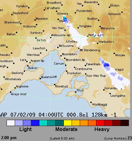
1.20pm Kilmore plume increases, Kinglake plume fades to the SSE.
1.30pm more so.

2pm Kilmore plume looks to have a more intense source then extends as a weaker plume on line between Kinglake - Yan Yean and extends SSE to Mt Dandenong. Smoke plume between Packenham and Noojee still there.
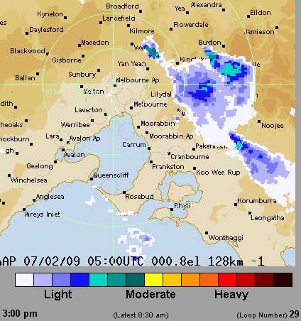
2.20pm  First sign thickening of plume just west Kinglake.
First smoke signature east of Buxton - NW of Marysville, could this time the ignition of the Murrindindi Mill fire which the police think was due to arson ?
2.30pm Kilmore plume almost separate from Kinglake plume. West Buxton signature intensifies.


3.00pm  Kilmore plume still almost separate from an intensified Kinglake plume and the new plume west of Buxton is more intense too and indicates a second source near Marysville. No plume near Flowerdale.
There is a gap in the Airport radar images between 3 and 4.50pm.

4.50pm Both Kilmore and West Buxton plumes merge and stream to SSE. Kilmore plume source is on line between Flowerdale and Wallan but closer to Wallan.
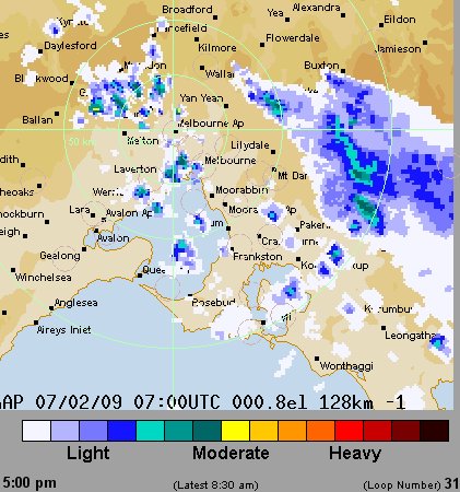
5.10pm From here the Kilmore plume seems to move up-wind and to the NNE, suggesting the fire source is migrating somehow to be closer to Flowerdale.
5.30pm Kilmore smoke plume strengthens and moves yet nearer to Flowerdale, now just past midway between Wallan and Flowerdale.
5.40pm Tendency for Kilmore plume to edge back upwind continues. West Buxton plume still separate source.
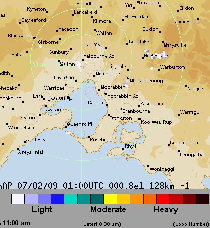
To the west,  these look like signatures of showers in a cool front.

6.10pm Kilmore plume nearer to Flowerdale and partly separates from Kinglake area.  More intense (yellow) radar signatures ~Kinglake area, West Buxton plume migrates over Buxton.
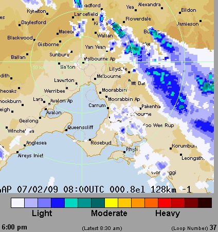
6.20 - 6.30pm Kilmore plume nearer Flowerdale and to the NW.

7.00pm Kilmore plume now should be named Flowerdale plume. Plume at Kinglake indicates source has moved to east of Kinglake, clear of smoke signature to west.

8.10pm Kinglake area of plume lessens and has moved from west to east of Kinglake.

Gap in images from 8.40 to 11.00pm when all plumes have lessened.


ihqihb